The Wisconsin River drops 1,071 feet from Lac Vieux Desert to the Mississippi, and people have put about 645 of those feet to work.
That is the math behind the nickname.
The Wisconsin Historical Society spelled it out in 1982 on Marker No. 269, which stands at the eastbound Interstate 90/94 rest area near Lyndon Station. It calls the Wisconsin the nation’s hardest working river. The state Department of Natural Resources uses the same title and says no other stretch of river in the United States carries more hydroelectric dams and storage reservoirs.
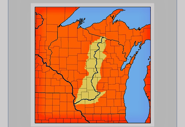
The river starts on the Michigan line and runs about 430 miles to Prairie du Chien. It drains 12,280 square miles, about a third of the state.
Along the way, the Wisconsin Valley Improvement Co. counts 25 working hydroelectric plants on the Wisconsin and its Tomahawk River tributary. Together they make about 936,000 megawatt hours of power in a typical year. The company says that covers the homes of more than 300,000 people.
The dams range from a 12.5 foot drop at Otter Rapids to a 92 foot drop at Grandfather Falls. Prairie du Sac is the biggest generator, at 29.5 megawatts.
The river’s thermostat
The power plants get the credit. The reservoirs up north make it possible for the work to be done.
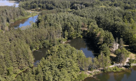
The Wisconsin Valley Improvement Co. was formed in 1907 under a state law written for the job. It owns 21 storage reservoirs in Vilas, Forest, Oneida, Lincoln and Marathon counties and Gogebic County, Michigan. Sixteen sit on natural lakes. All 16 started as logging dams the company bought in 1907 and 1908. The other five, Rainbow, Willow, Rice, Spirit and Eau Pleine, were built from scratch between 1911 and 1937.
None of those reservoir dams makes a single kilowatt. They hold back snowmelt and spring rain, then let it out when the river runs low.
The company says that steady flow raises power output by about 14 percent and cuts flood flows by as much as 30 percent in some places. The reservoirs control runoff from 1,931 square miles, about a sixth of the basin.
The power dams belong to paper companies and utilities. Each one is either licensed by the Federal Energy Regulatory Commission or exempt from it, according to the company. The historical marker calls that setup, private owners working under state rules, unique. It says that system is what earned the river its title.
Wausau’s tourism bureau traces the nickname back further, to the 1870s, when lumbermen named Stevens, McIndoe, Barker and Stewart put the river to work sawing pine.
Every dam on the river, top to bottom
Here is every dam that stands across the Wisconsin today, in order from Lac Vieux Desert to the Mississippi. Owners are those on record with the DNR’s dam database or federal licenses. Each name links to its DNR record.
- Lac Vieux Desert Dam, at the lake’s outlet in Vilas County. Wisconsin Valley Improvement Co. Storage only.
- Otter Rapids Dam, Vilas County, near Eagle River. Wisconsin Public Service Corp.
- Rainbow Reservoir Dam, Rainbow Flowage, Oneida County. Wisconsin Valley Improvement Co. Storage only.
- Rhinelander Dam, Rhinelander. Ahlstrom paper company.
- Hat Rapids Dam, south of Rhinelander, Oneida County. Wisconsin Public Service Corp.
- Kings Dam, north of Tomahawk, Lincoln County. Tomahawk Power and Pulp Co.
- Tomahawk Dam, Lake Mohawksin, Tomahawk. Wisconsin Public Service Corp.
- Grandmother Falls Dam, south of Tomahawk, Lincoln County. PCA Hydro Inc.
- Grandfather Falls Dam, Lincoln County, north of Merrill. Wisconsin Public Service Corp.
- Alexander Dam, Lake Alexander, north of Merrill. Wisconsin Public Service Corp.
- Merrill Dam, Merrill. Wisconsin Public Service Corp.
- Wausau Dam, downtown Wausau. Wisconsin Public Service Corp.
- Rothschild Dam, Lake Wausau, Rothschild. Domtar.
- Mosinee Dam, Mosinee. Ahlstrom paper company.
- DuBay Dam, Lake DuBay, Portage County. Consolidated Water Power Co.
- Stevens Point Dam, Stevens Point. Consolidated Water Power Co.
- Whiting Dam, listed by the DNR as Upper Paper Mill, Whiting. Consolidated Water Power Co.
- Whiting Plover Dam, less than half a mile downstream, Portage County. Neenah Paper. No power plant.
- Biron Dam, Biron, Wood County. Consolidated Water Power Co.
- Wisconsin Rapids Dam, Wisconsin Rapids. Consolidated Water Power Co.
- Centralia Dam, Wisconsin Rapids, below the city’s other dam. Domtar, which holds the federal license.
- Port Edwards Dam, Port Edwards. Domtar.
- Nekoosa Dam, Nekoosa. Domtar.
- Petenwell Dam, Petenwell Lake, Juneau County. Wisconsin River Power Co.
- Castle Rock Dam, Castle Rock Lake, Adams County. Wisconsin River Power Co.
- Kilbourn Dam, downtown Wisconsin Dells. Alliant Energy.
- Prairie du Sac Dam, a mile north of Prairie du Sac. Alliant Energy.
That is 27 dams. Of those, 24 make power and two only store water. The one at Whiting Plover does neither.
The 25th power plant on the company’s list, Jersey in Tomahawk, sits on the Tomahawk River, a tributary, not the Wisconsin itself.
Counts vary by source. The 1982 marker and the DNR both say 26 power dams. The company’s current list says 25 operating plants.
A few stops worth knowing
Grandfather Falls. The river drops 92 feet at this dam, the most at any site on the Wisconsin. Its 17.2 megawatts rank third on the river, behind Prairie du Sac and Petenwell.
Brokaw. A dam once crossed the river at Brokaw, north of Wausau. The Wausau Boom Co. built it in the early 1880s to sort logs, and Wausau Paper Mills later ran it, the Wisconsin Historical Society says. The DNR lists it as removed. Paddlers still steer around what is left.
Wisconsin Rapids. The city has two power dams because it used to be two cities. Grand Rapids on the east bank and Centralia on the west bank merged in 1900. The new city took the name Wisconsin Rapids in 1920, after too much mail ended up in Grand Rapids, Michigan.
Petenwell and Castle Rock. These two came last. DNR records date them to 1949 and 1950. Petenwell’s 25,180 acre reservoir is the second largest lake in Wisconsin, by the company’s count. Castle Rock adds 14,900 acres. The Wisconsin River Power Co. runs both and is owned half by Wisconsin Public Service and half by Alliant’s Wisconsin Power and Light. Buckhorn State Park sits on a peninsula in the Castle Rock Flowage.
Kilbourn. This is the Wisconsin Dells dam. Wisconsin Power and Light says it was built from 1906 to 1909 and was the largest dam west of Niagara Falls when it opened. It also raised the water enough for big boats to reach the Upper Dells, which helped build the tour boat business. The town was called Kilbourn City until it became Wisconsin Dells in 1931.
Prairie du Sac. The last dam on the river forms Lake Wisconsin, Alliant says. If you have ridden the free Merrimac ferry, you have crossed that lake.
Off the clock
Below Prairie du Sac, the river finally gets a break.
The last 92.3 miles to the Mississippi run free. The DNR says it is the longest free flowing stretch of river anywhere in the Midwest. There are no turbines down there. There are sandbars, bluffs and a lot of canoes.
After more than 330 miles on the job, the river has earned the time off. Most of us in Wisconsin know the feeling.