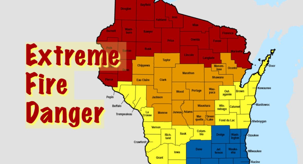
The Wisconsin Department of Natural Resources, in collaboration with the National Weather Service, has issued a Red Flag Warning effective today from noon to 9 p.m. for 22 northern Wisconsin counties: Ashland, Barron, Bayfield, Burnett, Douglas, Dunn, Florence, Forest, Iron, Langlade, Lincoln, Marinette, Oneida, Pierce, Polk, Price, Rusk, Sawyer, St. Croix, Vilas, and Washburn.

DNR and NWS Fire Condition Monitoring and Reporting
The Wisconsin DNR monitors wildfire risk through its Fire Management Program, using data from automated weather stations across the state to assess temperature, humidity, wind speed, and fuel moisture levels. These stations, operated in collaboration with the NWS, provide real-time weather data integrated into the DNR’s fire danger calculations. The DNR evaluates fuel moisture by measuring the dryness of vegetation, such as grass and forest litter, which influences how easily fires ignite and spread. Daily fire danger levels—categorized as Low, Moderate, High, Very High, or Extreme—are published on the DNR’s Wildland Fire Dashboard.
The NWS issues Red Flag Warnings when specific criteria are met: relative humidity at or below 25%, sustained winds of 15 mph or greater, and dry fuels, as outlined in NWS directives. The DNR uses these warnings to escalate fire prevention measures. The DNR also tracks wildfire incidents and updates burning restrictions daily, making this information publicly available online.
Current Restrictions
Due to the Red Flag Warning, the DNR has suspended all annual burning permits in the listed counties where it has authority, prohibiting open burning. The DNR advises the public to check recent fires to ensure they are extinguished and to avoid activities that could spark a fire.
For current fire danger levels, wildfire reports, and burning restrictions, visit dnr.wisconsin.gov/topic/ForestFire. Report wildfires by calling 911.remains critical.
For real-time updates on fire danger, wildfire reports, and burning restrictions, check the DNR Website. The DNR encourages the public to report any signs of wildfire immediately by calling 911.


